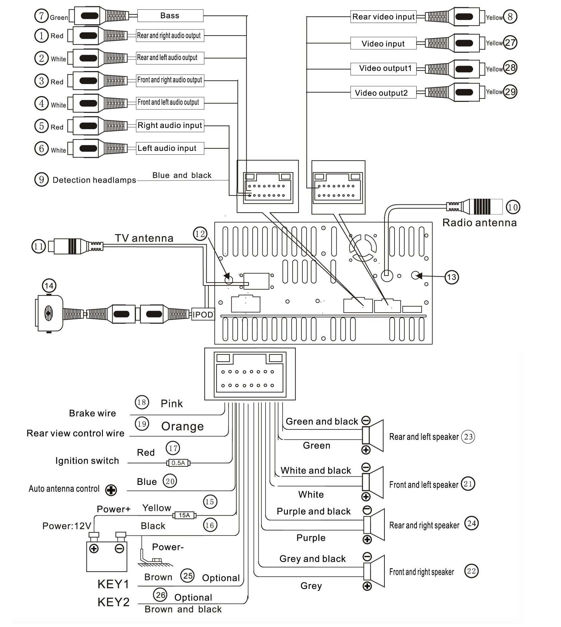
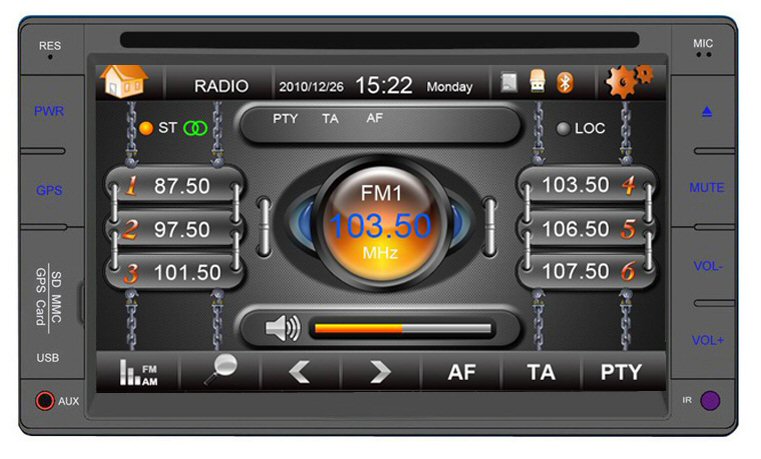
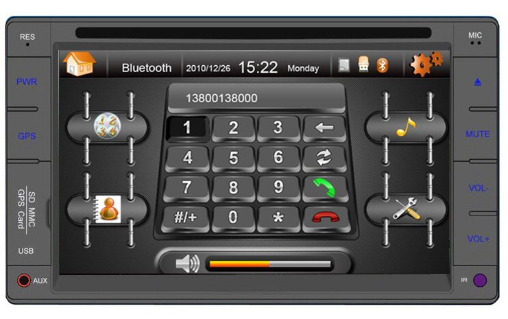
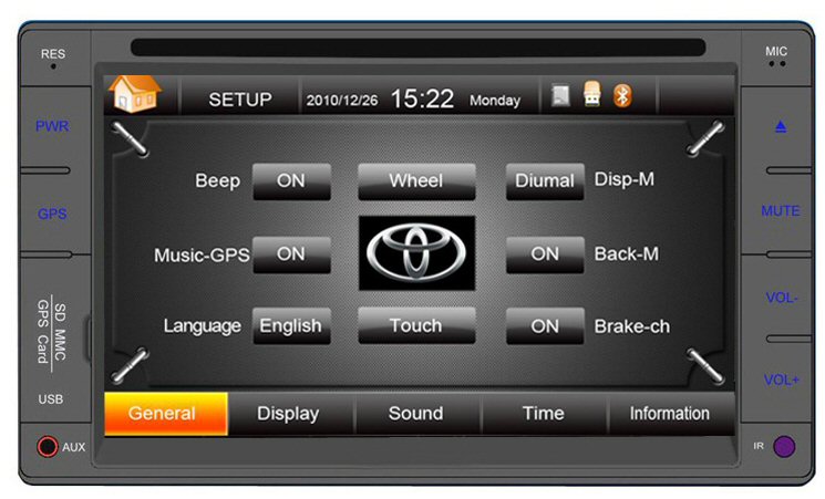
The units are shipped with the latest road mapping (included in the
purchase price.)READ THE FULL USER
MANUAL HERE
.jpg)
.jpg)
.jpg)
.jpg)
.jpg)
The units are
shipped with the latest road mapping (included in the
purchase price. Ozi Explorer is offered as an option
and must be done BEFORE the unit is shipped (or the unit
be returned for registering the unit etc)
READ THE OZI EXPLORER HELP FILE HERE
When the Ozi Explorer GPS option is purchased the unit
will display 2 icons when selecting navigation. You
will have the option of selecting either the standard
turn by turn road mapping or the off road mapping. The
Off-road mapping software is supplied by Ozi Explorer.
The mapping for both the off road is supplied by
Australain Geoscience maps using a 1:250K scale. The
only help available for the use for how to use Ozi
Explorer is via the link above, via online forums or
private tuition. The areas for the Geoscience maps cover
the entire Australian continent as well as the entire
coast line. If you have other maps or other scales then
these can be added to the SD card.
Select either Road maps or off road maps -
no need to change SD cards!
Ozi Explorer area covered using NAT Maps from Aus
Geoscience for Off road and Marine mapping.
These maps have been digitally converted for Ozi
Explorer.
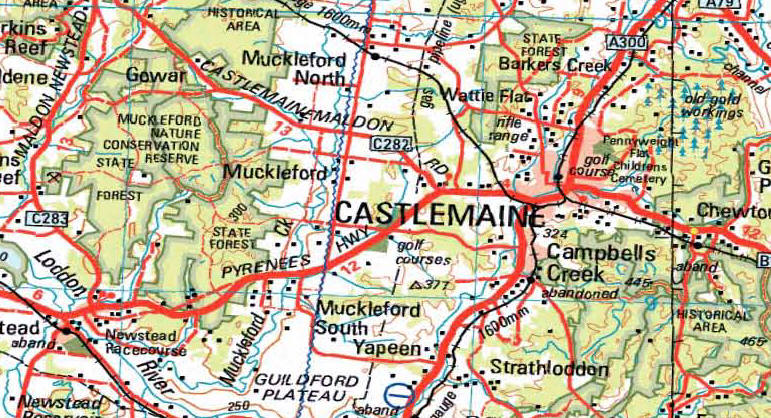
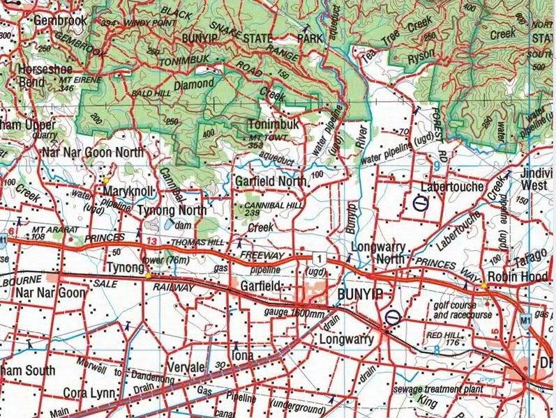
Ozi Explorer CE features:
Mark waypoints
Breadcrumb trail
Log & save tracks
Many map zoom levels
More/Less detailed maps
Automatic loading of next map
Roads
Major road to public or private track with minimum or no
construction
Hydrographic
Watercourse, canals, perennial lake, bore, well,
wind pump, waterhole, spring, swamp
Cultural features
Pipelines, tanks, homesteads, ruins, landmarks,
fence, levee, quarry, mine
Boundaries
State & territory borders, reserves and prohibited
areas
Railways
Tracks, stations, sidings and abandoned lines
Vegetation
Forest, scrubland, rain forest, plantation, orchard
Aircraft facilities
Airport, landing strip, helipad
Offshore & Coastal features
Boat ramp, lighthouse, reef, shoal, wreck, costal
flat, mangrove
Relief
Elevation, sand dunes, cliffs, sand ridges, pinnacle
and contour lines with value
Ozi Explorer area covered using Aus Geoscience off road
mapping: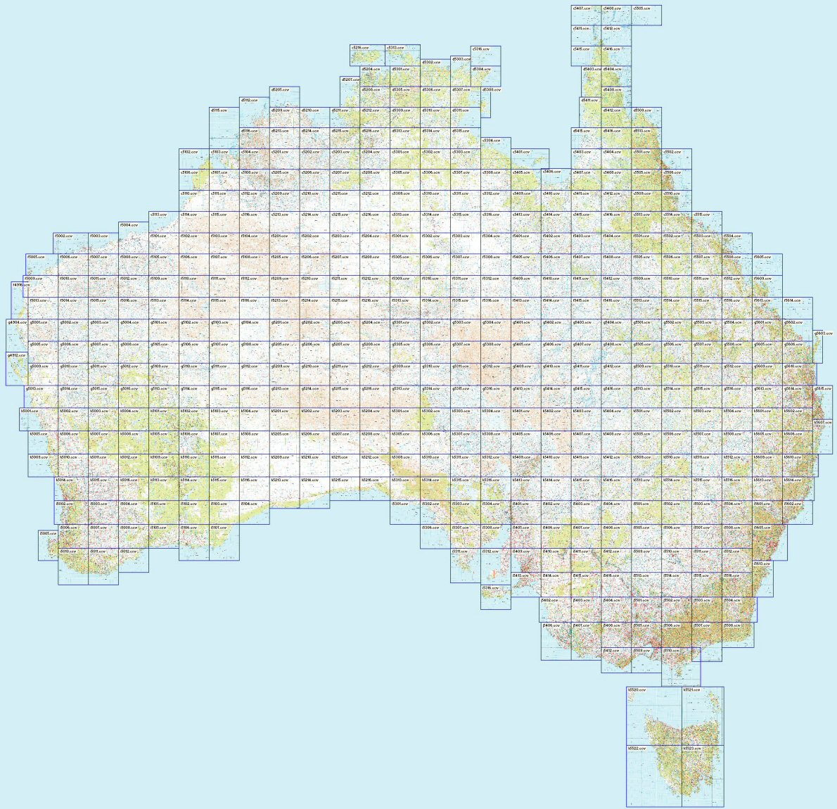
.jpg)