|
Motorcycle GPS 4.3"
STD BRACKET TO 23MM |
|
|
Adjustable bracket
25mm-30mm |
|
Extra Mounting Bracket |
|
Extra Charging Cable |
|
Express Post Australia Wide
 |
|
Ozi Explorer
|
|
|
VIC Fire maps 25K :1
(CFA maps) |
|
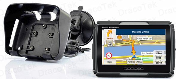
4.3" GPS with Digital LCD with Bluetooth
Manufacturer Specifications:
Primary Function: Portable GPS Navigator for Motorcycles
Display: 4.3 Inch Touch screen TFT Screen (Resistive)
Resolution: 480x272
Operating system: Win CE
Latest Mapping for Australia/New Zealand including red light/speed
cameras etc.
CPU: Media Tek MT3551 486Mhz
RAM: 128MB
Internal Memory: 4GB
External Memory: up to 8GB
Battery: Rechargeable Li-Polymer Battery, 950mAH
Charging Duration: ~3 hours
Operation Duration: ~3 hours (under constant use)
Standby Duration: ~6 hours
Supported Media Files
Video: AVI, ASF
Audio: WMA, WAV
Picture: JPG, PNG, TIF
Text: TXT
Speaker: Built in speaker
USB: 2.0
GPS:
GPS Module: High Sensitivity Receiver (NXP GNS7560)
Antenna: Built-in Internal Antenna
Sensitivity: -157 dBm
Hot start: <5 sec
Warm start: <38 sec
Cold start: <45 sec
GPS frequency: 1575.42 MHz
OSD Languages: English, French, Spanish, Portuguese, German, Polish,
Italian, Dutch, Thai
Dimensions: 128.5 x 88.7 x 20.4mm
Product Notes
Integrated GPS receiver with 42 Channel all-in-view tracking
Bluetooth is available, but only works with Bluetooth headsets.
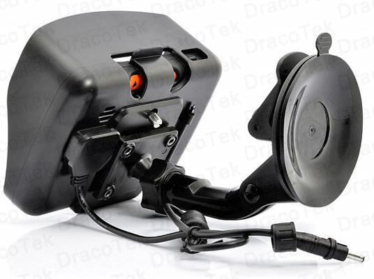
Easy to mount: comes with robust universal RAM mounting hardware that
fits almost any bike
Full multimedia features: movie, music, e-book, picture
This model is compatible with most brands of GPS software - however
hardware specific software such as Garmin may not run on this unit.
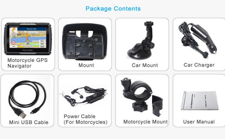
Package Contents
Peaklife Motorcycle GPS Navigator
Mini USB Cable
Cigarette lighter
Car Charger
Motorcycle Mount up to 23mm (For larger handles you will need to buy
longer screws)
Power Cable (For Motorcycles)
User Manual is available via the link below
Replacement Screws
READ THE
MOTORCYCLE MANUAL
HERE!
READ THE 6 RIDER BLUETOOTH MANUAL HERE
The units are shipped with the latest road mapping (included in the
purchase price. Ozi Explorer is offered as an option and must be
done BEFORE the unit is shipped (or the unit be returned for registering
the unit etc)
READ THE OZI EXPLORER HELP FILE HERE
MAPPING: When the Ozi Explorer GPS
option is purchased the unit will display 2 icons when
selecting navigation. You will have the option of
selecting either the standard turn by turn road mapping
or the off road mapping. The Off-road mapping
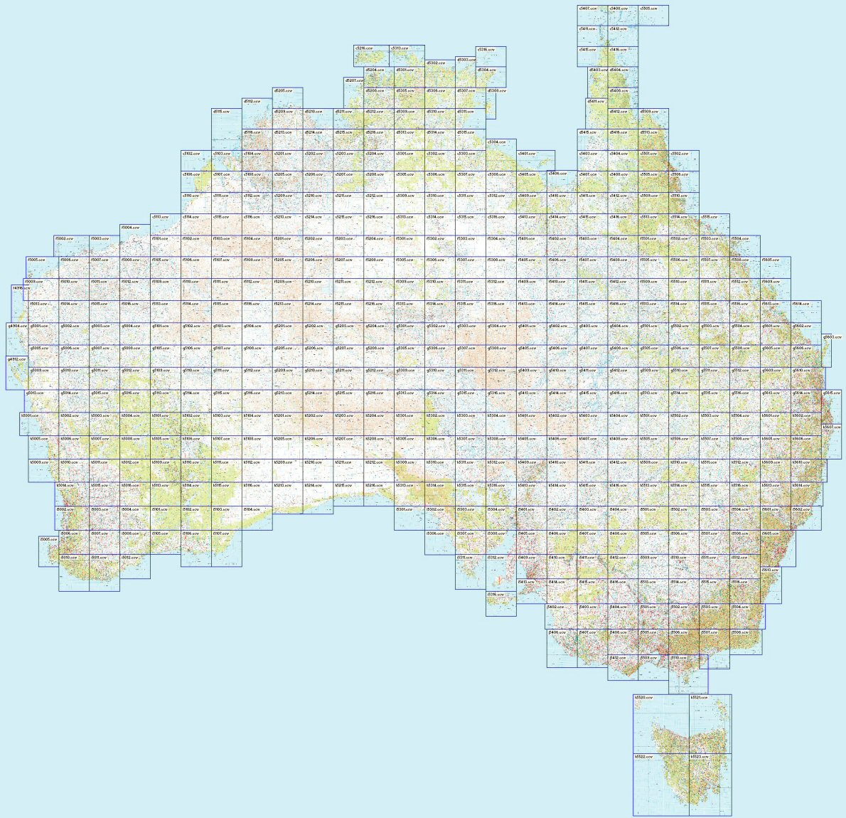
software is supplied by Ozi Explorer. The mapping for
both the off road is supplied by Australain Geoscience maps
using a 1:250K scale. The only help available for the
use for how to use Ozi Explorer is via the link above,
via online forums or private tuition. The areas for the
Geoscience maps cover the entire Australian continent as
well as the entire coast line. If you have other maps
or other scales then these can be added to the SD card.

Select either Road maps or off road maps - no need to
change SD cards!
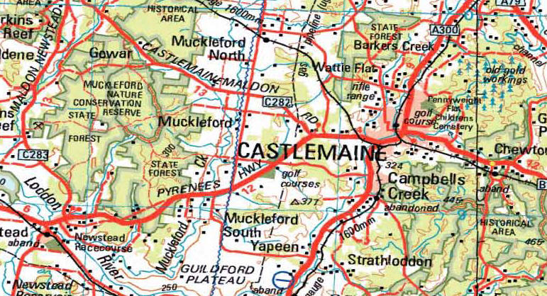
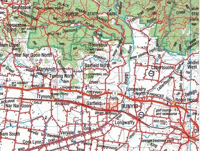
Ozi Explorer area covered using NAT Maps from Aus Geoscience
for Off road
and Marine mapping.
These maps have been digitally converted for Ozi
Explorer.
Ozi Explorer CE features:
Mark waypoints
Breadcrumb trail
Log & save tracks
Many map zoom levels
More/Less detailed maps
Automatic loading of next map
Roads
Major road to public or private track
with minimum or no construction
Hydography
Watercourse, canals, perennial lake, bore, well,
windpump, waterhole, spring, swamp
Cultural features
Pipelines, tanks, homesteads, ruins, landmarks,
fence, levee, quary, mine
Boundaries
State & territory borders, reserves and prohibited
areas
Railways
Tracks, stations, sidings and abandoned lines
Vegetation
Forest, scrubland, rain forest, plantation, orchard
Aircraft facilities
Airport, landing strip, helipad
Offshore & Coastal features
Boat ramp, lighthouse, reef, shoal, wreck, costal
flat, mangrove
Relief
Elevation, sand dunes, cliffs, sand ridges, pinnacle
and contour lines with values.
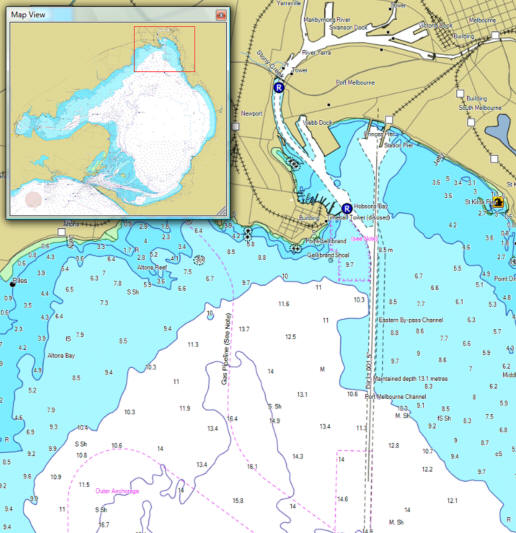
Typical Image of marine mapping - Port Phillip Bay
mapping provided
|